Alois Humer and Team
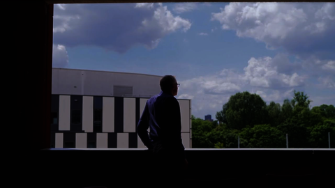
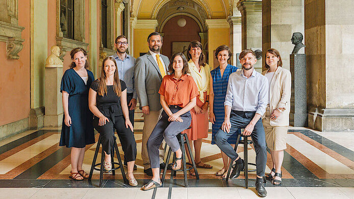
The geographer and spatial researcher Alois Humer is seeking solutions for integrative and sustainable urban and regional planning. Under the FWF’s emergency funding track, he is investigating the impact of the Covid pandemic on spatial development. The research team, f.l.t.r.: Elisabeth Gruber, Chiara Kupnik, Jiannis Kaucic, Alois Humer, Julia Haberfellner, Yvonne Franz, Sandra Guinand, Peter Görgl and Martina Schorn. © Daniel Dutkowski/Universität Wien

Dozens of heat-related deaths in Canada, devastating forest fires in the USA, southern Europe and Russia, heavy rain, floods and mudslides that bury entire towns – the summer of 2021 has made it very clear: climate change has arrived and brought in its wake weather extremes and all their dire consequences. A recent study by the University of California also reveals that heat stress in cities all over the world has almost tripled, the causes being climate change, population growth and urbanisation. Heat islands in cities, urban sprawl in the countryside and increasing traffic congestion present a challenge to urban and regional planners to find sustainable solutions.

16 football pitches built upon in Austria every day

Austria is the European champion in sealing up soil. Meadows and fields equivalent to 16 football pitches are built upon every day. Productive soil disappears under roads, housing estates, shopping centres and business parks. Earth is dredged away for ski slopes, lifts and water reservoirs. On the other hand, the Environment Agency Austria estimates that Austria harbours 40,000 hectares of land that is built-upon but unused.

The problem of urban sprawl and “doughnut villages”

The WWF Soil Report of February 2021 notes that three problem areas are particularly affected by land take. In Austria, one of the driving forces is urban sprawl, involving many people moving to the outskirts of towns and cities which spread out further and further into the surrounding countryside. A second driver are shopping malls, business parks and logistics centres encroaching on green spaces in the vicinity of urban areas, whereas the town centres feature abandoned retail premises and food and beverage outlets. “Doughnut village” is the name spatial planners give to the phenomenon of small-town centres becoming deserted while their fringes spread out. The migration of retail trade, production facilities and residential areas to the outskirts then leads to greater traffic congestion because it goes hand in hand with the construction of more roads and parking spaces. At 15 metres of road per capita, Austria has the densest road network in the whole of Europe.

Only seven percent still “natural open space”

The third problematic development is the construction of industrial-scale ski resorts and hydroelectric power stations. According to the WWF, only seven percent of Austria’s land surface can be considered “natural open space”. Most of these retreats for nature are to be found in the mountains. The consequences of building on more and more land are massive and far-reaching, because, once sealed with asphalt or concrete, soil loses its biological function: it cannot let water evaporate, will heat up intensely and increase the local temperature. Soil sealing also increases the risk of flooding because the soil can no longer absorb water – a pressing environmental problem in view of the expected increase in heavy rainfall and cases of flooding.

A threat to biodiversity and agricultural production

Roads also dissect the countryside, thus preventing the spread and migration of plants and animals, which in turn threatens biodiversity. In addition to the ecological impact, the relentless consumption of land – which mostly affects agricultural surfaces – also has negative economic consequences. Losing arable land for food production translates into an increased dependency on food imports.

“Nature takes 100 to 200 years to build one cubic centimetre of topsoil.” Alois Humer

Spatial development and climate change long-term processes

Although soil sealing can be reversed, such unsealing is a costly and time-consuming process. One should always bear in mind that soil regeneration is a lengthy process, as nature takes 100 to 200 years to build one cubic centimetre of topsoil. This highlights the difficulty of spatial development: similar to climate change, it is a very long-term process. Spatial researchers speak of the “persistence of space”: once in place, immobile installations such as buildings and road connections stay put for a long time and can even reinforce each other. This long-term aspect is a major challenge. But – and this is the good news – it can also have a positive effect. If we start creating spatial structures that, for instance, generate little unnecessary traffic, or if we foster residential areas with easy local access to education, services, health care and recreation, their effect will be just as long-term – but positive!

A new focus can give new life to old structures

“It’s a great challenge to get it right in practice,” says Alois Humer. But if you shift the focus in inner cities from car-friendly to pedestrian-friendly, for instance, centuries-old structures often regain importance. Humer gives an example: “Studies on small towns – such as Mödling – tell us that streets in the old town centre that were laid out centuries ago and which are still there can again be put to good use.”

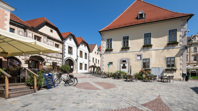
Mödling
If one shifts the focus in inner cities from car-friendly to pedestrian-friendly, centuries-old structures often regain importance. As is the case here in Mödling near Vienna. © Gerhard Wild/picturedesk.com

“Therein lies the rub”

Humer perceives a fundamental challenge of spatial planning in the contradiction between the limited nature of space and the fact that our economic and social system is geared towards growth. “Therein lies the rub, it’s inherent,” he notes, and he considers this conflict to be a highly socio-philosophical issue. “We cannot grant to every member of society uncontrolled, reckless spatial development. We need ways and means based on democratically acceptable principles to distribute space and create spatial justice. In practice, that is a very difficult undertaking that can be mastered only when approached as a society,” notes the 40-year-old Humer. This process is made even more complex by different temporal perspectives: society thinks in day-to-day terms, policy-makers think in time periods from one election to the next, but spatial development has to be approached by thinking in terms of decades.

“We need ways and means based on democratically acceptable principles to allocate space.” Alois Humer

Fragmented jurisdiction

In Austria, the situation is made worse by the fact that policy decisions that impact land development are fragmented between national, regional and local authorities. The federal government is responsible for forestry and water law, for example, while the provinces are responsible for land-use and building regulations and the local authorities are able to change the zoning of land. Hence, it’s the mayor who decides whether a business park is to be built or not, and local authorities woo companies to settle on their territory, because that brings money to the municipal coffers via local taxes. In Austria there are roughly 2,000 local authorities, each of which is responsible for its own zoning plan.

Regional goals and networked communities

How can these spatial planning challenges be solved in the face of global warming? According to Humer, the global goals must first and foremost be broken down to the level of local authorities and municipalities. Otherwise one will not be able to address them. The next and most important step is to create a network of local authorities and regions. Now is the time to think on a larger scale. Austria is already seeing more and more initiatives involving several small local authorities that join forces for intercommunal cooperation. INKOBA, an Upper Austrian intercommunal business settlement initiative, is a case in point. It involves several local authorities that establish only one, central industrial site. The tax income is then shared by all municipalities and not only benefits the one where the enterprise is located.

“City deals” – incentives for integral spatial planning

A number of examples of such cross-regional networking exist at the international level. The UK has introduced so-called “city deals” that offer incentives to promote integrative spatial planning. The central authorities negotiate bespoke funding packages with local authorities for major projects. This provides, for example, for ways of linking up residential areas to public transport networks. The so-called MAL agreements in Finland pursue a similar purpose. There, stakeholders responsible for land use, housing and transport or health and education facilities develop joint location strategies for a region – also across several local authorities. These initiatives then have access to special national funding sources. “That is something one should be daring enough to do in Austria,” says Humer, a native of Upper Austria. “It wouldn’t change any jurisdictions, but it would give the national authorities a certain say via soft, financial incentives for regional intersectoral cooperation. In that way, you can find solutions that make sense from an overall Austrian perspective.”

Tradeable land development certificates

Another strategic approach is trading in development certificates, similar to CO2 trading. Whereas land is consumed in booming regions in order to create residential space, regions that lose population attempt to eliminate vacant lots or re-naturalise brownfield sites. In this way, it is possible to achieve zero additional land take overall. Switzerland has set itself the goal of zero hectare growth. The Swiss spatial planning act (RPG), which has been in force since May 2014, states that new zoning of building land is not permitted until the cantons have revised their land development plans and reduced oversized building zones. According to Humer, Germany is also actively pursuing such a system of land development certificates, whereas it is still in its infancy in Austria.
Seestadt Aspern
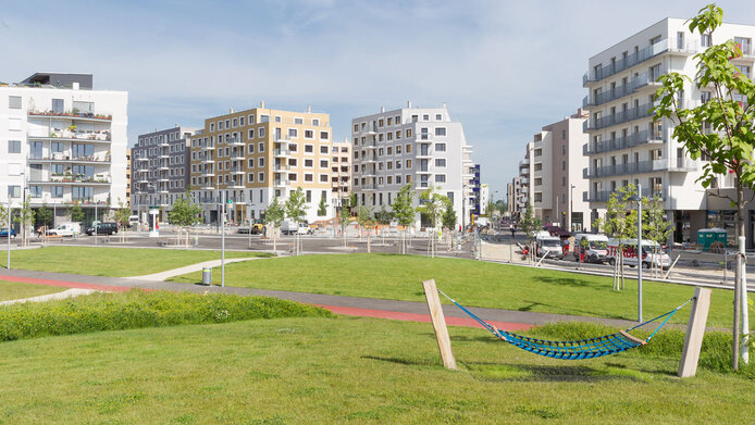
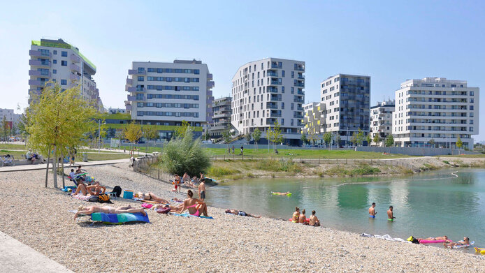
With an area of around 240 hectares, Seestadt Aspern, located in the east of Vienna, is one of the largest urban development areas in Europe. © Gilbert Novy/picturedesk.com
Seestadt Aspern, Vienna
According to Alois Humer, Seestadt Aspern in Vienna is an example of successful planning culture. On the one hand, because the public connection with the U2 extension was already in place before construction began, and on the other hand, there is a wide range of different types of housing, local amenities and services. © Wilfried Gredler/picturedesk.com

Seestadt Aspern – successful urban planning

Humer sees an example of successful planning culture in the new Seestadt Aspern neighbourhood in Vienna. The upstream extension of the U2 metro line meant that public transport connections were already in place before construction began. In addition, there is a wide range of different types of housing (rental, owner-occupied, subsidised housing, joint ventures by groups of future owners), plus local retail amenities and services. Humer likes the idea of making Seestadt Aspern a stop on the Vienna-Bratislava train line, which makes sense in terms of the large polycentric Vienna-Bratislava corridor.

Raised beds
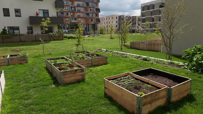
Residential construction projects increasingly resort to green compensation areas, which are important for both the microclimate and biodiversity in the city. The picture shows raised beds at Seestadt Aspern. © Robert Newald/picturedesk.com

Strengthening small and medium-sized towns

New urban development concepts are geared to so-called transit-oriented development (TOD), whereby development is accompanied by a transport concept with public-transport connections – as in the case of Seestadt Aspern. Another angle is to ensure more education and healthcare infrastructure for small and medium-sized towns. “This is where we need full-cost accounting. There should be financial benefits when a project is developed near public transport links and not on the periphery, where they seal up additional soil and cause more automobile traffic with its entire follow-up cost,” says Humer.

The future is about sharing

Humer sees the future in sharing concepts. He does not limit this to transport and also includes public space and housing. “But sharing has to be so flexible, uncomplicated and affordable that people don’t even want to keep a car anymore,” he says. In city centres, the car is a dying breed. The “Leipzig Charter on Sustainable European Cities” drawn up by the EU member states stipulates that there should be no more cars in city centres by 2050. “Once that has been achieved, you’ll see how much space will suddenly be available to people again,” says Humer.

“Sharing has to be so flexible and affordable that people don’t even want to keep a car anymore.” Alois Humer

Greening to combat heat in the cities

According to a recent study by the University of California, the burden of extreme heat in cities worldwide has nearly tripled in recent decades. The increase is caused by a combination of growing populations and global warming. So-called “heat islands” are causing increasing problems in cities. Urban planners are trying to respond to this problem by greening building facades or setting up compensatory areas that are designed to promote recreation and improve the microclimate. The “green centre” in Vienna’s Nordbahnhof neighbourhood is a case in point. The city abandoned the original plan to build no higher than six storeys, but covering the entire area, and instead resorted to buildings of ten to twelve storeys. As a trade-off, a “central green area” is left free of buildings. This is important both for the microclimate and for biodiversity in the city. “In such an urban ‘ruderal site’ there is more biodiversity than on soil with intensive, and usually monoculture, agricultural use,” says Humer.

Will the pandemic lead to an urban exodus?

All over the world, cities are growing, and the challenges of residential space, heat and traffic urgently require solutions. At the same time, the Covid pandemic seems to have made city life a great deal less appealing, if reports about increased demand for housing outside of cities are to be believed. But could this societal event really have the power to reverse the trend toward urbanisation? “The Covid pandemic was not really good news for sustainable urban development”, says Alois Humer. He clearly considers the 21st century to be the age of urbanisation and a renaissance of inner cities, and adds: “Recent studies before the pandemic showed, for example, that even young families were opting for the city, and that urban living triumphed by catering to pluralistic lifestyles seeking education, culture and internationality.”

But then came the pandemic, and the measures introduced to contain it. Suddenly, the benefits of city living were eroded. It seemed as if people living in the less densely populated suburbs or in the countryside were able to weather the crisis in better shape, since they had easy access to nature. Going for a walk experienced an unexpected sharp boost in popularity. The densely built up spaces of the city became a disadvantage. Will the pandemic thus have the power to lastingly reverse the trend towards urbanisation? Humer has his doubts and points to the lessons of history showing that socio-political interventions cannot put a stop to long-term socio-demographic trends. Under the FWF’s urgent funding track, Humer and his team at the Institute of Geography and Spatial Research at the University of Vienna are currently investigating whether these doubts are justified.

“Setting the mood against city life is a problematic game.” Alois Humer

Map-based online survey of 30,000 households

To this end, the researchers will launch a major survey among 30,000 Austrian households in cities, suburbia and the periphery. The respondents will be asked how satisfied they are with their housing situation or living environment and whether anything has changed during the pandemic. The researchers will employ a new method that combines a standardised survey with cartographic aspects. By means of the maptionnaire survey methodology, the researchers can survey an individual’s radius of action in everyday life and then cross-reference the results with statistical data such as age, purchasing power, etc. The method was developed at Aalto University in Finland, where Humer worked between 2017 and 2020 on strategic spatial planning in shrinking cities and regions in the context of an Erwin Schrödinger Fellowship from the FWF. Data collection is scheduled to start in spring 2022.

Media images of the pandemic in urban and rural areas

At the moment, the scientists are working on the development of the questionnaire, based on a media analysis. In the process, Humer wants to perform an evidence-based check of the reliability of media reports highlighting geographic consequences of the pandemic, such as increased urban exodus. “We will examine how well-founded these news stories are and whether they might be promoting real estate in peripheral locations. It is a problematic issue if the media encourage living in the countryside, given the associated problems such as inefficient land use and urban sprawl,” notes Humer.

Digitalisation and land take

Digitalisation, which has increased over the past ten years and was given a huge boost by the pandemic, is another important factor for urban and regional development. Working from home and online shopping are the most noticeable new aspects of everyday life with relevance for land take. Is online shopping more efficient, i.e. having the goods come to the customer instead of the customer to the goods? What is its impact on the balance of land consumption? Humer does not yet have a scientifically proven answer, but it is his hypothesis that digitalisation consumes more land. The booming online retail trade, for instance, consumes space for logistics and infrastructure.

“As digitalisation continues, we’re likely to consume even more space.” Alois Humer

Sometimes one sees a combination of the real and the digital space. A current example is found in the newly opened IKEA store at Vienna’s Westbahnhof. The furniture store advertises car-free shopping and has no parking spaces or warehouse space. Orders are placed online or digitally on site. The goods are delivered – by vehicle, of course. The increasing amount of data requires ever-larger data centres, which also use up land, consume energy and interfere with ecosystems. Society still has to come to grips with digitalisation. Humer is very concerned about contracts with unlimited data plans. “That’s comparable to leaving the tap and the heating on at full blast,” is the comparison he uses, and he adds: “Digitalisation doesn’t do anything to improve the throwaway society.”

The spatial planning of the future

There are many arguments and factors to be considered when discussing the urban and regional planning of the future. According to Humer, it is eminently important to make sure future spatial planning experts receive interdisciplinary training. He perceives great potential in the synoptic overview perspective that his discipline provides. It might be of great help in finding solutions for the complex, multifaceted problems that a city is confronted with: “From soil sealing to heat islands to social justice – all issues have an impact on urban development, and we are the ones who can read these trends.” Creating awareness for a planning culture that is long-term and inclusive and does not get bogged down in individual cases – that’s the big challenge. The future is now: a new geography master’s programme with a focus on global change and sustainability started in October 2021. This new generation of geographers will address these complex questions that inform development.

Personal details

Alois Humer is Professor of Spatial Research and Planning at the Department of Geography and Regional Research at the University of Vienna. A native of Upper Austria, he studied geography at the University of Vienna and conducted research on strategic spatial planning for shrinking areas at Aalto University in Finland from 2017 to 2020 as part of an FWF Erwin Schrödinger Fellowship. He and his team are now investigating the long-term effects of the Corona pandemic on urban and regional development in the FWF-funded acute project CURB.