More moisture in the Arctic than thought

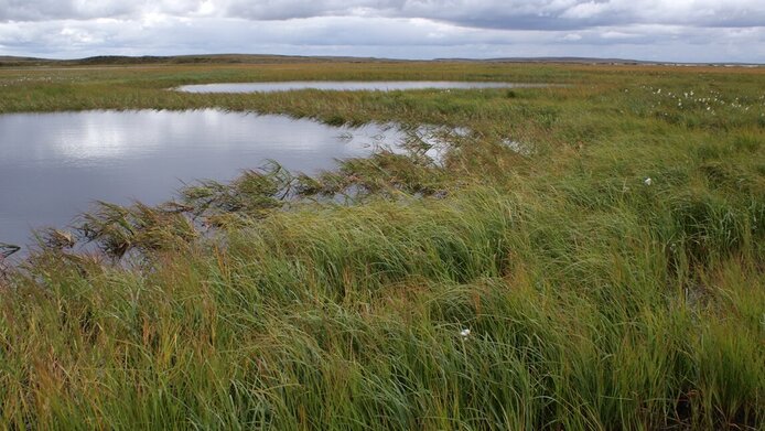
To be able to improve existing climate models and examine the polar habitats of wild animals, knowledge of the extent of the wetlands in the Arctic region is crucial. However, even in the 21st century, this is more complicated than one would expect. The inhospitableness and sheer size of the land mass makes the use of special methods essential. A particularly high-resolution method has now been developed by a team working on a project sponsored by the Austrian Science Fund FWF and has been published in the "International Journal of Remote Sensing".
Scattering
At the core of this new method is the influence of vegetation and the surface structure on the so-called backscattering of a special radar signal emitted by satellites. Project manager Annett Bartsch from the Austrian Zentralanstalt für Meteorologie und Geodynamik (ZAMG) elaborates in the interview with scilog: "Our studies showed that, in winter, the backscattering of this signal is particularly low in areas with vegetation that is typical for wetlands. The resolution of the signal even allows us to differentiate between different degrees of moisture, something that was almost impossible before now."
Moving RADAR
The radar used for these measurements is called Synthetic Aperture Radar (SAR) and permits two-dimensional scene mapping. "For our analysis, we used data collected by the Envisat satellite of the European Space Agency between the years 2002 and 2012," says Bartsch, explaining the basis of the work carried out by her team. "The spatial resolution of this data is between 120 and 1000 metres – significantly higher than the resolution of previously available data for measuring Arctic wetlands."
Winter & summer
By drawing comparisons with known regional land-use maps, Bartsch and her team discovered that there was a relationship between the particularly low backscattering of the signal in winter and wetland-typical vegetation. The team not only identified and localized the lowest backscattering values of the winter months, but also compared the winter and summer values. "This actually revealed that where a particularly large difference was found between these values, the soil moisture was also very high. This is an effect caused directly by the moisture and not by the vegetation," says Bartsch. However, although this difference appeared to be a more suitable method for identifying wetlands, measuring the minimal values of the winter months subsequently proved to be the better choice.
Research with class
"Another analysis showed that the minimal values from the winter months can be better correlated with various degrees of soil moisture than the winter-summer difference," explains Barbara Widhalm, a staff member working on the project. "This allows us to differentiate between up to three classes of moisture." This sounds very promising, but in its publication the team also mentions that there is currently no large-scale data that would enable independent validation of the results. What does exist, however, are references to soil moisture in numerous land-use maps that could be used as a reference for confirming the validity of the SAR measurements. "When we analyze the measurements of the entire Arctic polar region on this basis," says Wildhalm, summarizing the results of this work, "then we discover that up to 30 percent of the country north of the treeline should be classified as wetlands. Up until now, we had estimated this to be at between one and seven percent." The new method developed with FWF support therefore appears to be more sensitive than previous methods and could potentially have a major influence on future climate models and habitat studies.
About Annett Bartsch Annett Bartsch is head of the specialist department on climate impact in the area of data, methods, models of the Zentralanstalt für Meteorologie und Geodynamik (ZAMG) in Vienna. The focus of her research is satellite-based remote sensing of land surfaces in the far north. She has won both the Hertha Firnberg and Elise Richter grant from the FWF, thereby allowing her to expand her research at the Department of Geodesy and Geoinformation at the Technische Universität Wien.
Publication


